

Parul Gupta –
This summer, Toronto has a new way to experience its eastern waterfront.
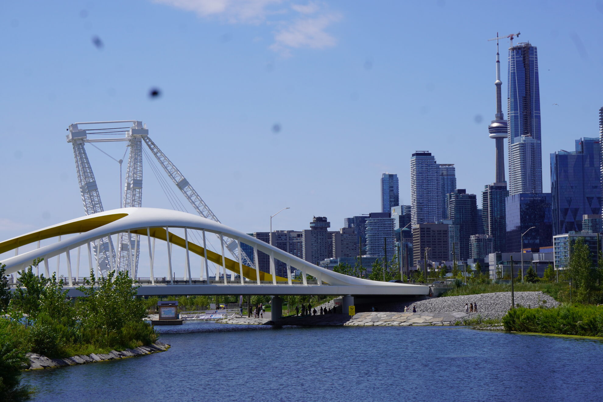
At the western edge of Ookwemin Minising, the city’s new island in the Port Lands, a four-hectare western expansion of Biidaasige Park has opened. The new section features the restored 300-ton Atlas Crane, Canoe Cove, the Lassonde Art Trail and new waterfront paths.
This carefully designed public park is the result of a much larger transformation: a $1.4-billion effort to reshape the mouth of the Don River, protect the eastern waterfront from flooding and restore natural habitats on land that Toronto spent more than a century industrializing.
Ashbridges Bay, once a major freshwater marsh, fishing ground and important gathering place for Indigenous peoples, was gradually filled to make way for factories, railways and shipping. The Don River was straightened, and its mouth redirected toward the Keating Channel, fundamentally changing the landscape and its relationship with Lake Ontario.
With the park’s new expansion, that relationship is being reimagined. The Port Lands Flood Protection project created a new kilometre-long river channel that reconnects the Don River to Lake Ontario and helped form Ookwemin Minising. The project protects 174 hectares of land from flooding while creating the foundation for a new waterfront community.
Biidaasige Park brings together naturalized landscapes, public space, art and recreation. Its shoreline offers places to walk and launch non-motorized watercraft. Its trails and gathering spaces have turned the once-industrial land into a place to spend the day.
Its ecological restoration is equally significant. The park and its new greenspaces feature more than 5,000 trees, 77,000 shrubs and two million herbaceous plants – an effort to restore the natural landscape of the Port Lands, including wetlands, aquatic habitat and native plant communities.
But perhaps the most meaningful change is less visible.
The island was officially named Ookwemin Minising, meaning “place of the black cherry trees.” The surrounding park was named Biidaasige, meaning “sunlight shining towards us,” following a years-long process involving an Indigenous Advisory Circle.
The names reflect the ecology and history of the land, while Indigenous design and placekeeping have also been incorporated into the park and broader planning of the island. Together, these efforts recognize Indigenous histories, knowledge and continuing connections to the land.
For Franca Leeson, president of the Canary District Neighbourhood Association, that history of reclamation matters.
“We live on formerly polluted industrial lands; it’s part of our history,” she says. “Canary District could not become a residential neighbourhood until methods were developed to make our ground safe. We see a kinship with Ookwemin Minising in this respect.”
“Biidaasige Park has the potential to be a jewel in Toronto’s crown and an incredible tourist attraction,” she says. “The key is ensuring that people can reach it safely.”
Leeson says residents have embraced the new park, but reaching it from the surrounding neighbourhoods is not as straightforward as maps suggest. The Cherry Street rail underpass can feel cramped, while the Lake Shore Boulevard East crossing remains difficult for pedestrians and cyclists.
A pedestrian and cycling bridge across the Lower Don River had been part of earlier plans associated with the Ontario Line’s East Harbour Transit Hub. Metrolinx described a dedicated multi-use bridge as part of the project in 2021, while by 2024 it noted a potential pedestrian/cycling bridge and outlined other ways to reach the East Harbour Station. But the bridge is not part of the current East Harbour construction contract.
For Leeson, the issue is whether the neighbourhoods around the park can connect to it easily without relying on cars.
The city’s updated 2026 plan anticipates approximately 12,000 homes and 21,000 people on Ookwemin Minising over the next 25 years, along with jobs and new community infrastructure. Communities already living nearby are concerned about limited infrastructure as the neighbourhood grows. The plan includes a community recreation centre, neighbourhood library, community space, an elementary school, childcare facilities and a fire station.
“If people start moving into the new neighbourhood before infrastructure is in place, traffic is going to be a serious issue,” Leeson says.
“The increased foot traffic hasn’t made much of a difference for the shopkeepers in the area,” she says. “We hope that will change once more housing is built in the Port Lands and Quayside and the East Bayfront LRT is up and running.”
The East Bayfront transit connection is now moving forward as part of the broader Waterfront East Transit project.
Toronto has spent more than a decade reshaping the Don River, transforming a piece of waterfront once defined by industry and environmental damage. The park that has emerged is a glimpse of what the eastern waterfront could become when flood protection, ecological restoration, Indigenous placekeeping, art and public space are considered together.
But can the city make it feel truly connected to the neighbourhood around it?

1 Comment
How can disabled people visit the park?